
Description
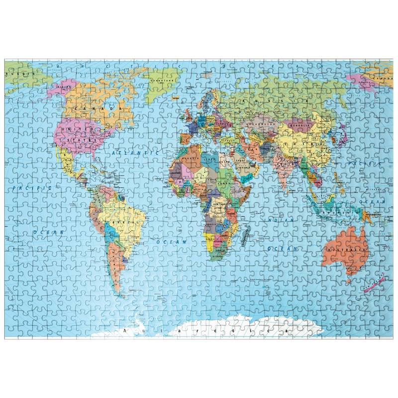
500 Puzzle Color World Map – Borders, Countries, Roads And Cities From The Starlight Puzzle Special Collection Exclusive To Mypuzzle.Com.A Color World Map Is A Visual Representation Of The Earth’S Continents, Countries, And Geographical Features. It Typically Shows The Boundaries Between Different Countries And Territories, As Well As Major Roads, Cities, And Other Points Of Interest. The Map Is Labeled With A Few Names Of Countries, Cities, And Other Geographical Features, And May Use Different Colors To Distinguish Different Regions Or Political Divisions. Overall, A Color World Map Is A Useful Tool For Understanding The Geography And Political Divisions Of The World.


Reviews
There are no reviews yet.